August 15, 2017

One of the newest additions to Hansen, Allen & Luce’s engineering team is a remote-controlled flying survey drone.
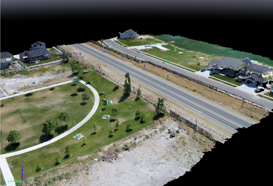
The DJI Phantom 4 Pro quadcopter expands our surveying and engineering capabilities by providing faster, broader, and safer coverage with both pre-programmed and manual flights. Equipped with GPS and a 4K camera, the drone can capture high-resolution aerial imagery and photogrammetric topography for most sites in a matter of minutes or hours. The data are then post-processed and rectified with ground points for a complete surface characterization.
HAL’s drone has already supported several projects since entering service earlier this year, including waste grade surveys at Intermountain Regional Landfill and a pedestrian undercrossing in Tooele County. The drone is operated by our professional land surveyor who is also a licensed pilot.
For more information on our drone surveying services, please contact us.
Images: 3D photogrammetry (left) and digital surface model (right) acquired in Tooele County, Utah.